
Walk a Mount Prospect Street
A Mount Prospect street directory search works best as a chain, not as one broad name query. Ownership appears in parcel and deed records. A taxpayer mailing field may point elsewhere, and a voter or directory entry is dated. Treat each result as one part of the address history.
- Enter the complete address in the Cook County Assessor search. Follow its direction rule and omit the street suffix from the Street Name field.
- Capture every returned PIN. Check CookViewer and the Village GIS when one address maps to multiple parcels, units, or condo records.
- Compare the situs address, tax-bill mailing address, owner or taxpayer field, ZIP, and tax year.
- Search the PIN in the Cook County Clerk’s CRS index. Follow grantor, grantee, document number, and prior-instrument links backward.
- For occupancy evidence, check a known voter through the official lookup or consult a dated MPPL criss-cross directory.
Finish by recording the source and access date. The same name at the same address in two independent records is stronger than one undated directory hit. It still does not identify every person in a household.
Mount Prospect Assessor Fields
The Cook County Assessor Address Search offers PIN, Address, Neighborhood, and Advanced Search modes. Address mode requires House Number, Street Name without a suffix such as Street or Avenue, City, and CAPTCHA. Direction is a select field, and Unit Number is optional. A basic address search has no visible ZIP field, so the property-information portal or USPS should handle a ZIP mismatch.
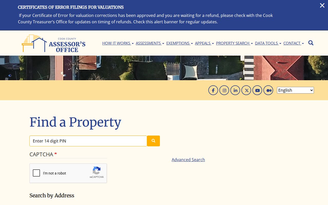
The image shows the official starting controls. The online page describes current assessment data but does not state its earliest coverage year. If the interface or CAPTCHA prevents access, call the Assessor at (312) 443-7550, visit the office at 118 N Clark Street, Room 320 in Chicago during its stated weekday hours, or ask about a branch and township-assessor route.
| Mode | Fields visible | Street use |
|---|---|---|
| PIN | 14-digit PIN, CAPTCHA | Return to one known parcel |
| Address | Number, direction, unit, street, city | Resolve one street address |
| Neighborhood | Township, neighborhood, property class | Compare a wider area |
| Advanced | Additional property and owner-oriented filters | Narrow results when available |
Tax Details by Mount Prospect Address
The Cook County property-information search accepts a 14-digit PIN or a house number, street, unit, city, and ZIP. It can add tax code, classification, assessed values, building and lot size, five-year exemption history, five-year billed amounts, tax-bill mailing address, and a recorded document or lien summary.
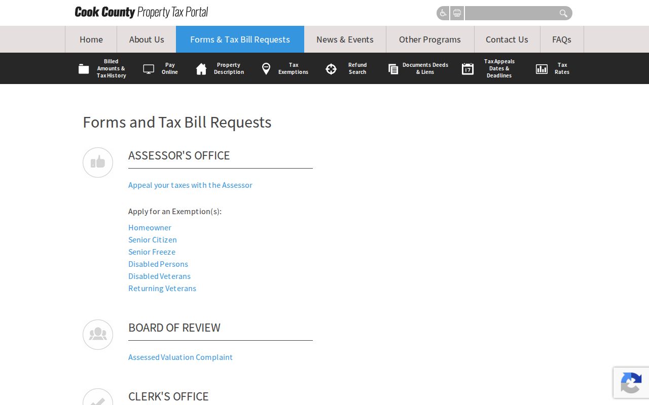
The captured portal supplies a second official view of the parcel. Keep its meanings separate: the situs is where the property sits, while the tax-bill address is where the bill goes. A trust, business, agent, public body, or owner living elsewhere may receive it. An exemption can be evidence that a claim was made for a tax period, but it is not conclusive proof that a named person occupied the property for the whole year.
Map Mount Prospect Parcels Nearby
CookViewer accepts a 10-digit, 14-digit, or dashed PIN, plus property address or intersection. Results can open property details, comparison tools, Nearby Search, and print or report controls. Condo parcels may appear as a stacked list, so inspect every returned item instead of choosing the first.
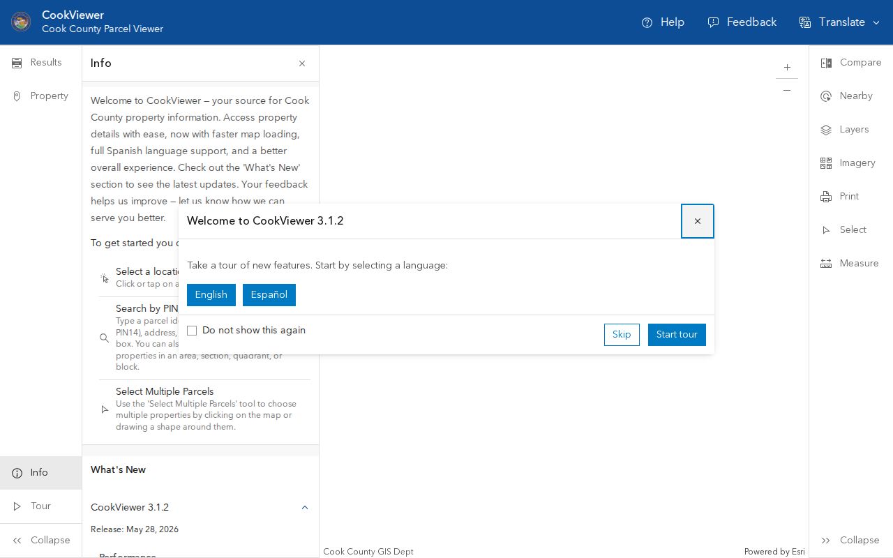
The image shows the county map used to move from one parcel to the next. CookViewer 3.0 and 3.1 added mobile and Spanish support, full condo PIN handling, measurements, reports, and historical imagery back to 1998. Release notes were current through May 28, 2026. Controls can change, so note the version and access date beside any street-directory result.
Historical imagery can show how a block or building footprint changed. It cannot establish who occupied a home. Pair it with a dated property file, deed, directory, permit, or newspaper record.
Read Mount Prospect GIS Rows
The Village GIS map service can turn a street into a set of parcel rows. Its layers cover corporate boundaries, addresses, buildings, parcels, roads, utilities, flood areas, townships, zoning, parks, schools, precincts, and public-service areas. Parcel fields include full address, PIN, ZIP, zoning, subdivision, quarter section, annexation year, district values, service providers, and taxpayer mailing data.
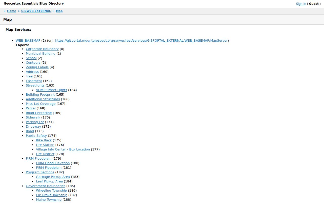
The screenshot links to the official municipal map source. An exact query for 10 N Emerson Street returned two parcel features, which shows why one address should not be forced into one result. A public sample at 50 S Emerson Street returned a commercial parcel with a PIN, 60056 ZIP, B5C zoning, precinct 7, Elk Grove Township, subdivision, and 1917 annexation year. It named the Village as taxpayer, making it useful for teaching fields without exposing a private household.
- Parcel
- A mapped land unit tied to a PIN.
- Situs address
- The physical property address, distinct from a mailing address.
- Plat
- A recorded map that divides land into lots, blocks, streets, or easements.
- Criss-cross directory
- A dated directory arranged by address or telephone number.
Mount Prospect Street Record Coverage
The Mount Prospect street directory draws on record sets with different subjects, dates, and access rules. The parcel PIN connects most property sources. Street spelling and unit data connect permits and older directories. A known person’s details are needed for the official voter check.
| Address-linked source | Record keeper | What the street result means | Access channels |
|---|---|---|---|
| Assessment roll | Cook County Assessor | Current parcel and owner-oriented tax fields | Portal, phone, office, branch help |
| Property and tax file | Cook County property offices | Mailing, assessment, bill, exemption, deed summary | Portal, forms, office request |
| County and Village GIS | Cook County and Mount Prospect | Parcel shape, nearby lots, districts, services | Free web viewers and REST data |
| Recorded instruments | Cook County Clerk | Dated grantor, grantee, lien, deed, or plat role | CRS index, counter, archive, paid copies |
| Permit and code files | Mount Prospect | Project, applicant, contractor, inspection, status | Citizenserve, department, defined FOIA request |
| Voter registration | Illinois election authorities | Known voter’s registration check, not a street list | Restricted official lookup and lawful file route |
Utility provider fields in GIS show who serves an area, not who holds an account. Public customer lists and usage data are not a Mount Prospect resident roll. Likewise, a permit applicant may be a contractor or agent rather than the owner or occupant.
Follow Mount Prospect Deeds
The current land-record portal is the Cook County Clerk’s CRS search. The separate Recorder of Deeds office ended when its duties merged into the Clerk on December 7, 2020. Older deeds may still say “Recorder,” but the current address and PIN search belongs in CRS.
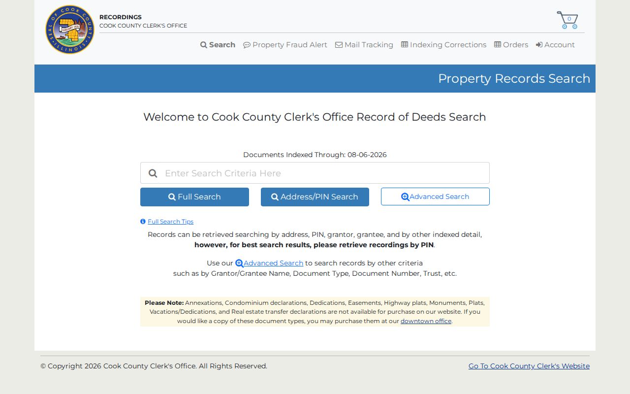
The screenshot shows Full Search, Address/PIN Search, and Advanced Search routes. Start with the current PIN. Read each result for recording date, instrument type, grantor, grantee, document number, legal description, and any prior instrument. A grantor transfers an interest; a grantee receives it. Neither label proves current occupancy.
The displayed index-through date was August 6, 2026, but CRS did not state the earliest online year. Ask the Clerk about older deed books, tract indexes, plats, archive access, and copy options when the online chain stops. The 2024 schedule listed a $107 base total for several standard recording classes, effective April 1, 2024; verify the current fee before ordering because copy and instrument charges differ.
Legal Descriptions Rescue Street Searches
An address can fail after a renumbering, subdivision, parcel split, condo conversion, or annexation. A legal description often lasts longer than the street label. The CRS Advanced Search provides section, township, range, subdivision short name, condominium or acreage selection, block, lot, and part-of-lot fields. It also supports grantor or grantee name, document type, date range, consideration bounds, trust number, and exact document number routes.
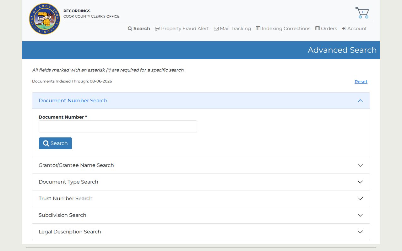
The advanced screen supplies the fallback when an address query appears to end. Search the stable lot or subdivision data, then follow prior grantors and grantees across a bounded date range. For the pre-indexed period, request help from the Clerk or archives rather than assuming no deed exists.
Insider tip. When CRS finds no address, switch to the PIN, legal description, and prior party names before changing the street spelling at random.
Mount Prospect Addresses Cross Boundaries
Mount Prospect records carry several geographic identities at once. Village history places incorporation in 1917, while some southern areas developed under county regulation and were annexed in the 1970s and 1980s. The GIS annexation-year, township, quarter-section, and subdivision fields can point to the correct earlier custodian. A pre-annexation permit or land matter may sit in county or township records even when the parcel has a current Village address.
The postal layer adds a second trap. USPS identifies 60056 with Mount Prospect, while the Village parcel layer also contains 60004, 60005, 60016, and 60070 values. The 60070 postal city is Prospect Heights, yet that ZIP can appear in the municipal parcel dataset. Validate a specific mailing address with USPS, preserve the city label returned by each system, and use the PIN to keep the parcel identity stable.
Past Occupants Along Mount Prospect Streets
For an older occupant, the Harold Weary Genealogy Room at Mount Prospect Public Library holds the street-oriented sources missing from modern parcel systems. Its resources include Haines and criss-cross directories, telephone books, newspapers on microfilm, obituary and biography indexes, business files, and reference databases. A 1999 survey recorded regional phone books for 1937–50, a 1974 local phone book, and Paddock directories for 1965–66, 1969, and 1972.
Search the address side of the dated volume, then reverse the name in the alphabetical side. Compare it with a deed, parcel, newspaper, obituary, or Mount Prospect Historical Society house file from the same period. The Mount Prospect city directory collections cover the shelf and its year runs in detail. Contact MPPL reference staff or arrange historical-society research when the volume is not online.
Note: A criss-cross entry reports what one dated publication printed; it does not prove continuous residence or include every household member.
Limits of Mount Prospect Street Directories
A street directory can show parcels, owners, taxpayers, deed parties, permit roles, or a dated directory occupant. It cannot provide a complete current list of renters, children, guests, utility customers, protected participants, or everyone who receives mail at an address. Motor-vehicle address data is restricted, and vital, adoption, voter, sealed, juvenile, and expunged records follow their own limits.
Illinois Safe at Home can provide an eligible participant with a substitute address for public-record interactions. Recorder redaction rules also cover sensitive identifiers, and FOIA exempts categories of private information. Do not try to reverse a substitute address or republish personal identifiers. Commercial neighbor tools may merge stale or unrelated records, while an official portal states a narrower purpose and custodian.
Lawful use. Use Mount Prospect address records for family history, property research, scam checks, or civic questions. Never use them to stalk, harass, threaten, or harm a person.